The State Meteorological Agency (Aemet) has activated new warnings before the imminent arrival of Emilia, a deep squall that will begin to impact Spain from Thursday night, but whose most intense effect will be felt on Friday, December 12.
The agency warns of an episode of instability marked by torrential rains, very intense wind, sea storms and snowfall in mountainous areas.
An Atlantic front that consolidates between Cadiz and the Canary Islands
According to the Aemet, the core of Emilia will be located on Friday between the Gulf of Cadiz and the Canary Islands, moving cold and humid air that will leave persistent rainfall in the southwest peninsular, the Strait and much of the islands. The rains may be accompanied by storms and hail, a scenario that will be repeated during the early hours of Saturday.
The weather agency also stresses the probability of snowfall at high altitudes of the Peninsula: even the Canary Islands could record episodes of snow on the highest peaks, due to the cold air associated with the squall.
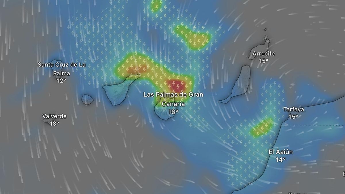
Most affected areas: from the Strait of Gibraltar to the Canary archipelago
The forecast indicates that the Canary Islands will be one of the territories most affected by the squall, with a particularly complex weekend. From Friday very intense showers are expected, but it will be on Saturday 13 when the storm will gain strength, first in the eastern islands and, hours later, in the western ones.
The Aemet forecasts gusts above 90 km/h in mountainous areas, as well as an intense swell that could generate risky situations in coastal areas. The agency warns of the possible fall of branches, displacement of objects, occasional flooding and a strong sea storm that could drag people on breakwaters, beaches or cliffs.
On the Peninsula, the most outstanding episodes will be concentrated in:
-
Southern Andalusia
-
Ceuta and Melilla
-
Strait areas
These torrential rains could spread towards the Mediterranean coast throughout the weekend, reaching regions such as Murcia, Valencia, Catalonia and the Balearic Islands.
From Sunday, Emilia will begin to lose strength as it moves eastward. Even so, the squall will leave a trail of instability that could remain in the southeast and Levante early next week, with intermittent showers and cloudy skies over much of the country.
Temperatures: slight increase in general and occasional decrease in the Canary Islands.
In spite of the storm, temperatures will not experience large drops: in fact, in areas of the inland west and the Ebro valley a moderate rise is expected, with values that could be between 10 and 15 degrees, somewhat high for mid-December.
In contrast, minimum temperatures will drop in the Canary Islands and in areas of the northwest peninsular, where the arrival of cold air and the north wind will favor a more winter-like atmosphere: weak frosts will persist in the mountains of the northern half and snowfalls are not ruled out on the peaks of the highest islands.
The storm Emilia is one of the first major storms of the season and is accompanied by a sharp contrast in temperature, widespread rain and a particularly aggressive wind in the Canary Islands. Although the situation will tend to improve on Sunday, the Aemet maintains the recommendation to exercise extreme caution in the areas most exposed to rain, wind and waves.