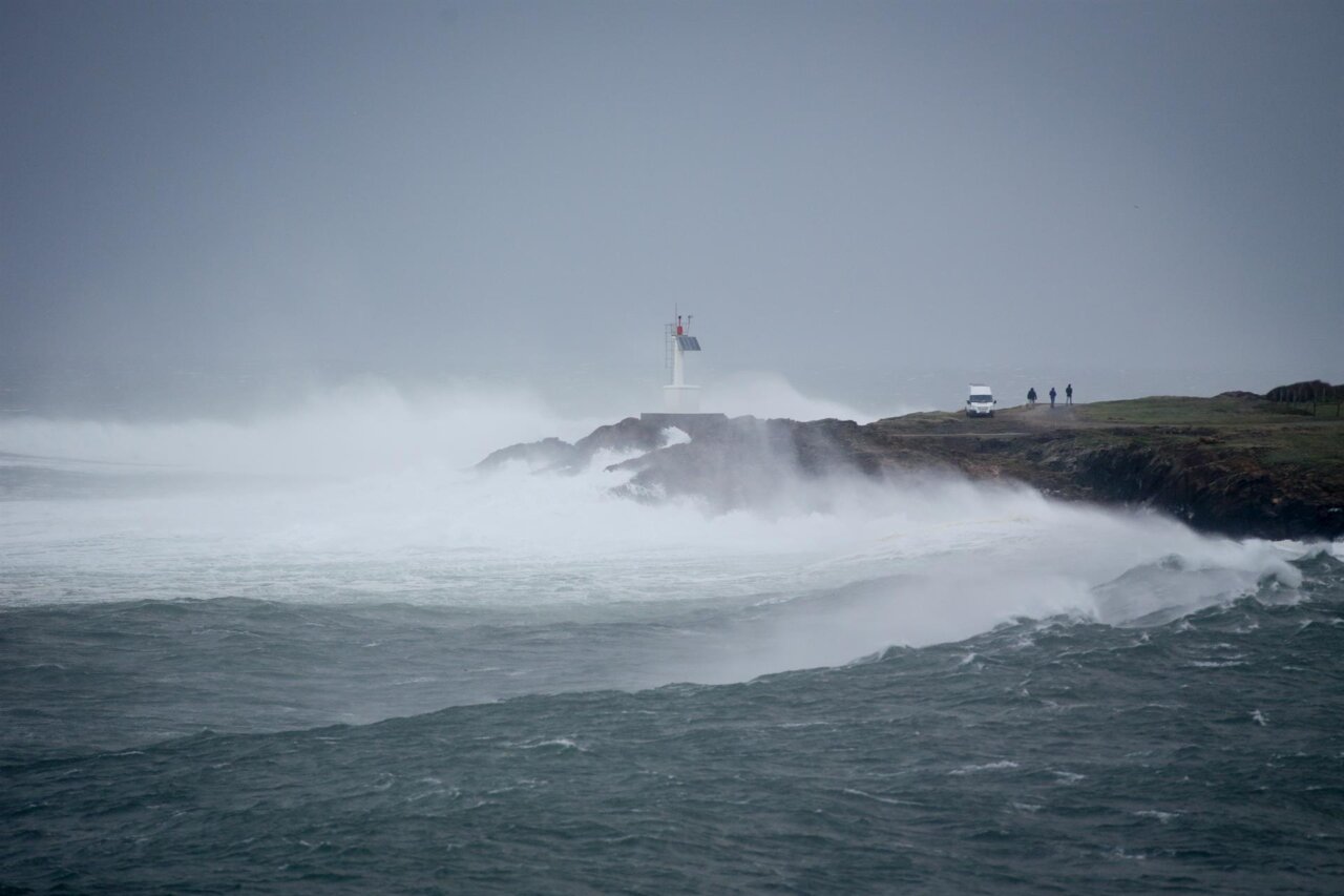
The squall, which has put 16 autonomous communities in check, will reach the Mediterranean and the Balearic Islands in the coming hours, after crossing the Peninsula from the northwest. Ibiza and Formentera are expected to be among the most affected areas, with a yellow warning for winds of up to 70 km / h between 10:00 and 20:00 hours this Monday. The worst part is being taken by Galicia, in red alert for waves.
Adverse phenomena at sea and in the mountains
In the maritime environment, southwesterly winds could reach force 7, accompanied by waves of 3 to 4 meters from the early hours of the day. On land, instability will manifest itself with likely scattered showers and thunderstorms, while on Tuesday could register light hail and heavier rainfall. The snow level will drop to 1,200 meters in Mallorca.
Impact on the Balearic Islands and the Peninsula
The entry of a polar air mass is responsible for the drop in temperatures and the formation of the squall, which could evolve into a DANA (Isolated High Level Depression) on Wednesday. While in Ibiza and Formentera no cancellations on sea routes are reported yet, in the rest of Spain, the mountain system and the Cantabrian areas are already experiencing significant accumulations of snow.
Tips and precautions
The Aemet insists on extreme caution in the face of wind gusts and the risks associated with the storm. For those who must travel or perform outdoor activities, it is recommended to consult weather updates and avoid coastal areas during the day. With the squall expected to persist until Saturday, local authorities are on alert to mitigate possible impacts and ensure the safety of residents and tourists.