The Sant Antoni Town Council has announced the start of work on the drafting of a new General Urban Development Plan(PGOU), a key tool that will replace the current planning approved in 1987 and published in 2001. This project, considered a priority by the Consistory, seeks to respond to the current needs of the municipality and define its long-term development, adapting to current regulations.
A step towards a more accessible and sustainable Sant Antoni
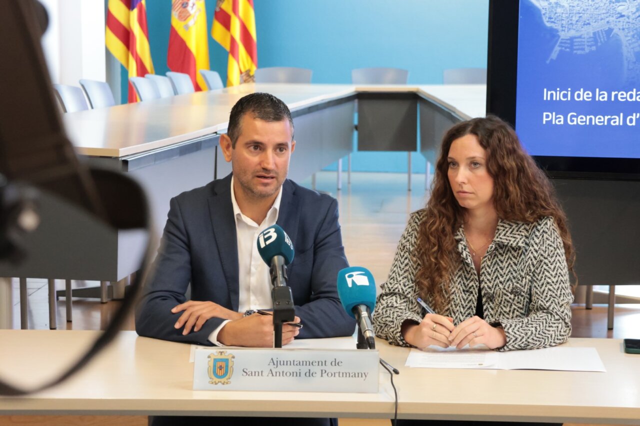
Mayor Marcos Serra has underlined the importance of the process, highlighting that the new PGOU will allow “to give legal coverage to current problems”, such as small developments on rural land, known as Rural Environment Settlements (AMR), and the growing demand for parking, through the delimitation of new areas of facilities. Serra also emphasized that the plan will include the creation of green spaces, sports and educational areas to improve the quality of life of citizens. For her part, the Councilor for Urban Planning and Activities, Eva Prats, stressed that the municipality is “in luck” thanks to the new law of administrative simplification that allows Sant Antoni, with a population of 28,600 inhabitants, to formulate a single general plan covering structural and detailed urban planning. “Our priority is to build a more accessible, practical and sustainable Sant Antoni,” said Prats, emphasizing the global vision with which this planning will be approached.
Participatory process and deadlines
The City Council will work with a drafting team, which will be selected through a public bidding process. As explained by the mayor, the plan is expected to be approved in advance in 2025, at which time a participatory process will be opened so that citizens can contribute their suggestions. However, the subsequent phases, including initial, provisional and final approval, will depend on reports from other administrations, which makes it difficult to establish specific dates.
Update needed after decades of modifications
Since its approval, the current PGOU has undergone 15 specific modifications, seven of which have been processed between the last and the current legislature. This accumulation of changes, together with the need to incorporate the abundant regional and insular regulations enacted in recent decades, has led the City Council to undertake a complete revision of the plan. In addition, work will be done on the digitalization of the current cartography, currently in physical format, to solve interpretation problems related to alignments, plot boundaries and zoning, among others.