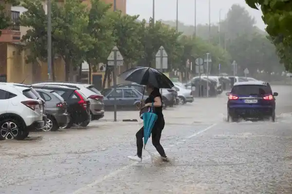
The passage of an Atlantic front associated with squall Claudia will mark the weather especially in Galicia, where heavy and persistent rains are expected, with the possibility of isolated storms and gusts of wind from the south that will strongly affect coastal areas.
According to the State Meteorological Agency (Aemet), the maritime storm will also cause waves of up to six meters on the west coast of Galicia.
The rest of the country, with more stable weather
While the northwest will experience a day of instability, in the rest of Spain the atmosphere will be calmer and more stable, with a predominance of clear skies.
However, clouds and light showers are expected in some areas of the Cantabrian area, the Atlantic and the Central System, as well as mist and morning fog in the mountains of the Atlantic slope and the southern plateau.
Precipitation could also extend to the west of Castilla y León, the northwest of Extremadura and parts of the Central System, while frontal mists will form in western Galicia.
Canary Islands, next to feel the effects of storm Claudia

The squall Claudia will also impact the Canary Islands, although it will do so from Wednesday, with rain and strong winds forecast. The sky will be overcast in the western islands, with probable weak rains, and clearer in the rest of the archipelago.
Temperatures will remain around 24 degrees maximum and 20 degrees minimum, with light wind and light breezes, more intense in higher areas.
Indirect effects in the Balearic Islands:
Although the meteorological phenomenon will affect with greater intensity in the west of the peninsula and the Canary archipelago, the islands of Ibiza and Formentera will feel the indirect effects of Claudia due to a flow of warm and dry air. On the islands, a significant increase in temperatures is expected throughout the week.
Maximum temperatures could reach 24 °C, while minimum temperatures could be around 18 °C. This episode will be accompanied by moderate to strong southerly wind and the arrival of suspended dust, which will generate the phenomenon known as calima and cloud the sky, and may produce mud showers at certain times, according to the AEMET.
In the Balearic Islands as a whole, the concentration of these particles will be noticeable from Wednesday morning, and forecasts indicate that the haze will persist until Friday, when the mass of warm, dry air will begin to move eastward.
Higher temperatures and frost in mountain areas
Maximum temperatures will rise in most of the country, except in the center and in some areas of the east, where they will hardly vary.
In general, daytime temperatures will be between 18 and 20 degrees. Minimum temperatures will also rise, with slight decreases in the Mediterranean and the Canary Islands.
The lowest of the day will be around 3 degrees in León and Cuenca, with localized moderate frosts in the Pyrenees.
Winds from the south will blow moderately in the Peninsula and the Balearic Islands, stronger in the Cantabrian, the Mediterranean and the north of the Atlantic slope, where greater intensity is expected in Galicia.