After the recent passage of Francis, the State Meteorological Agency (AEMET) has confirmed the formation of a new depression system in the Atlantic. This is the Goretti squall, the seventh of great impact so far this season. According to weather models, this phenomenon will develop between Thursday and Friday, mainly affecting western Europe.
The particularity of this system is that it will deepen very quickly, a process technically known as explosive cyclogenesis. Although this condition usually generates intense meteorological phenomena, the AEMET estimates that the core of the storm will remain far from the Peninsula, so its impact on Spanish territory will be moderate compared to other surrounding countries.
When does the new storm Goretti arrive?
The new Goretti squall will begin to define itself during the day on Thursday, January 8. The process of cyclogenesis involves a drastic drop in atmospheric pressure in a few hours, which usually translates into an increase in the intensity of wind and waves.
However, in Spain the impact will be collateral, manifesting itself mainly through a cloudy front that will enter through the northwest peninsular.
Despite this new phenomenon, on Thursday, anticyclonic weather will prevail in most of the country: the exceptions will be Galicia and the Cantabrian area, where overcast skies and some precipitation are expected, with the most important accumulations in the western half of the Galician community.
Rain and wind forecast: what the weather will be like
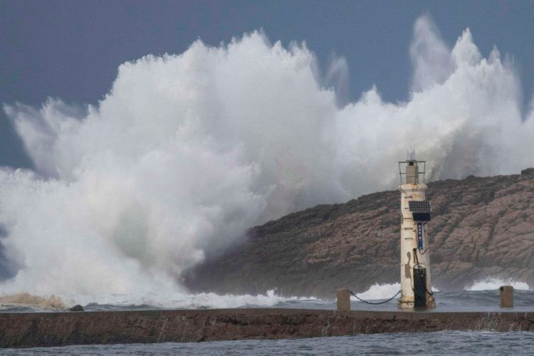
As for the real impact, the Goretti squall will cause a worsening of the sea conditions on the north coast. Stormy seas and gusts of wind are expected on the coast, while in the rest of the northwest quadrant and the Pyrenees the rains will be rather weak and scattered.
On the other hand, the Mediterranean slope and the Balearic Islands will have light cloudy skies with just a few high clouds.
The snow elevation in the northern mountain systems will initially be between 1,400 and 1,600 meters, although the tendency is to rise rapidly to 1,900 meters as the day progresses. This is because the entry of air associated with this system will not be accompanied by extreme cold, but by a change in the air mass.
Widespread thermal rise under the new squall
A highlight of the forecast is the general increase in temperatures. In spite of the arrival of the new squall, the thermometers will register notable rises in both maximum and minimum temperatures: this rise will be especially marked in the eastern third of the Peninsula and in the Balearic archipelago.
In areas of the Pyrenees, the thermal increase could be extraordinary compared to the previous days of frost. Thus, Spain faces the end of the week with a milder environment, moving away from the cold storm for the time being, but keeping track of the evolution of wind and waves on the Atlantic coast.